You know how dealing with local council regulations often feels like shooting at a moving target.
The gazettal of VC248 on May 5, 2026, brought significant updates to the Victoria Planning Provisions.
We see this challenge regularly when developing a bmo bushfire compliance landscape project in Melbourne's north-east.
These recent changes mean getting your landscape design approved requires strict adherence to updated safety measures.
Let's break down exactly what this compliance involves and the specific design strategies required for approval.
Our team wants to help you build a beautiful garden that safely meets these rigorous standards.
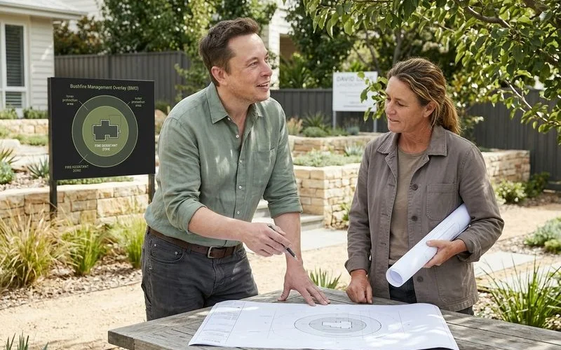
## What the BMO IsThe Bushfire Management Overlay (BMO) is a planning control applied to land identified as having significant bushfire risk under Clause 44.06 of the Victoria Planning Provisions.
Within this designated area, residential building work and significant landscape changes need to demonstrate that defendable space is established and maintained around the dwelling.
We regularly check the Department of Transport and Planning's VicPlan tool because mapping updates can catch property owners by surprise.
Across Melbourne's north-east, this specific overlay covers:
Over 60% of the Nillumbik Shire currently falls within this critical safety zone.
If your block has bush boundaries, a mature canopy, or a slope falling toward bushland, these strict planning controls almost certainly apply.
## Defendable SpaceDefendable space is the actively managed ring of land around your dwelling designed to reduce the effects of radiant heat and flame contact.
This critical buffer zone slows the spread of fire and gives emergency services a safer environment to work in.
We divide this space into distinct areas based on Country Fire Authority (CFA) standards.
The compliance documentation specifies the exact dimensions based on your block's Bushfire Attack Level (BAL) rating, the terrain slope, and orientation relative to prevailing fire risks.
For a property built to a BAL-12.5 standard, you must prepare for a maximum radiant heat flux of 12.5 kW/m2.
This dictates exactly how far your vegetation buffer needs to extend.
The managed ring around your home typically includes two distinct areas.
The CFA's specific 10/50 exemption rule often applies in these designated BMO areas.
This regulation allows homeowners to remove trees within 10 metres and clear understory vegetation up to 50 metres from an existing house without a separate planning permit.
Our designs carefully incorporate these clearance zones to satisfy local council requirements.
## Planting Palette in the BMOFire-resistant native species serve as the standard foundation for any approved defendable space landscape design.
The Victorian government requires strict spacing, meaning individual shrub clumps must not exceed 5 square metres in area and must maintain a 5-metre separation from each other.
We select plants based on the CFA's current 'Landscaping for Bushfire' guidelines to ensure swift council approval for your bushfire overlay landscaping melbourne project.
Practical choices for Melbourne's north-east include the following reliable options.
You must actively exclude certain plants to maintain a safe and compliant property.
Oily eucalypts are strictly banned in the inner zone, along with dense conifers and any plants that quickly build up dry leaf litter.
Climbing species are also prohibited because they create vertical fuel ladders that carry ground fires into the canopy.
Our team ensures all retained canopy trees have a minimum clearance of 2 metres between the ground and the lowest branches.
This strict vertical separation is a non-negotiable requirement for final compliance sign-off.
The full list of permissible species sits in your site-specific bushfire compliance documentation.
## Hardscape as BufferHardscape elements like paving, gravel, and retaining walls provide an essential non-flammable buffer that breaks up continuous vegetation.
These solid features do double duty in the BMO, acting as both usable garden spaces and engineered fire breaks.
We frequently use specific non-combustible materials to form a protective ring right at the boundary of the inner zone.
A 1.5 to 2-metre wide hardscape ring at this edge is a common and highly effective pattern.
It reads as a deliberate design feature, such as a paved walkway around the house or a gravel border at the lawn edge, while functioning primarily as a safety measure.
Comparing different non-combustible surfaces helps determine the best fit for your slope and budget.
| Material Type | Common Application | Fire Safety Benefit |
|---|---|---|
| Bluestone Paving | Patios and main walkways | Zero flammability, highly durable under heat |
| Exposed Aggregate | Driveways and wide paths | Continuous non-combustible barrier |
| Decorative Gravel | Lawn borders and plant bed mulch | Replaces flammable organic wood mulch |
Sloping blocks often require extensive retaining walls to manage soil stability.
Non-combustible materials like masonry or stone are mandatory in these high-risk areas to prevent the walls themselves from becoming a fuel source.
Our construction plans also factor in mandatory emergency vehicle access for deep properties.
For homes sitting more than 30 metres from the road, the CFA requires a trafficable width of 3.5 metres and a 15-tonne load capacity for fire trucks.
## The Compliance Documentation for BMO Bushfire Compliance LandscapeEvery landscape design in this overlay requires formal documentation, typically starting with a Bushfire Hazard Site Assessment (BHSA) and a Bushfire Management Statement (BMS).
This specific paperwork proves to the local council that your design actively mitigates the risks of your terrain.
We produce this extensive documentation as part of our core design package.
The application details exactly how you will meet Clause 53.02 requirements and must clearly map out several critical elements.
The landscape work cannot proceed until the relevant authority signs off on the compliance paperwork.
For subdivision projects in a high-risk area, councils often require a Section 173 agreement registered directly on the property title.
Our team submits the completed package to the council alongside your building or planning permit application.
This step ensures all future owners remain legally aware of their ongoing maintenance obligations.
For the broader council-permit context, see landscaping permits in Banyule and Nillumbik.
For the design-stage detail on slope-specific design, see the sloping block design process.
Ready to move forward safely?
Contact our studio today to schedule a site assessment and secure approval for your bmo bushfire compliance landscape design.